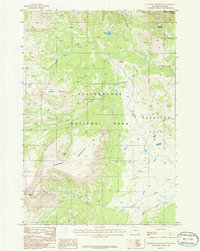
1986 Map of Quadrant Mountain
USGS Topo · Published 1986About this map
Yellowstone National Park dominates this 1980s topographic study, capturing a high-elevation landscape at the border of Wyoming and Montana. The terrain is defined by the massive presence of Quadrant Mountain and the neighboring Little Quadrant Mountain, which rise above the basin known as Gardner Hole. This area serves as a primary drainage system for numerous waterways, where Gardner River meets tributaries like Glen Creek, Fawn Creek, and Panther Creek. A series of mountain summits including Sepulcher Mountain and Bannock Peak frame the wilderness. The map reveals the intricate network of the park's early trail systems and the isolation of features such as The Pocket and Cache Lake. This record provides a detailed look at the backcountry geography before modern shifts in park management and infrastructure, highlighting the geological complexity of the Gallatin Range's eastern edges.
Find a feature on this map
16 named features on this map. Tap any name to fly to it.
Don’t see what you’re looking for? This feature index may not catch every label — zoom into the map to look around manually.
Map Details
Editions of this 1986 Quadrant Mountain Map
This is the sole edition of this map. No revisions or reprints were ever made.
Other maps of this area

1885 · Gallatin
USGS Topo · 1:125,000

1885 · Gallatin
USGS Topo · 1:125,000

1891 · Livingston
USGS Topo · 1:250,000

1893 · Livingston
USGS Topo · 1:250,000

1901 · Gallatin
USGS Topo · 1:125,000

1908 · Gallatin
USGS Topo · 1:125,000

1911 · Gallatin
USGS Topo · 1:125,000

1947 · Bozeman
USGS Topo · 1:250,000

1948 · Bozeman
USGS Topo · 1:250,000

1955 · Bozeman
USGS Topo · 1:250,000