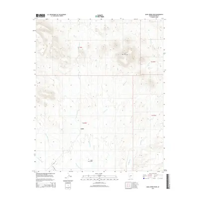
2014 Map of Quail Spring Wash
USGS Topo · Published 2014About this map
The Gila Bend Mountains dominate this arid landscape in southwestern Maricopa County, characterized by a complex network of seasonal drainages that define the local topography. The small settlement of Saddle serves as a lone hub of activity, situated near the intersection of W Saddle Rd and S Poco Dinero Rd. The map meticulously records the natural drainage system of the desert floor, featuring the convergence of Quail Spring Wash, Fourth of July Wash, and Yellow Medicine Wash. These desert arroyos, including Loudermilk Wash and Woolsey Wash, are critical markers for understanding the historical hydrology and movement across this portion of the Arizona desert. The inclusion of cadastral boundaries like t3s r8w and t2s r7w provides essential reference points for land ownership and historical survey research in this remote terrain.
Find a feature on this map
14 named features on this map. Tap any name to fly to it.
Don’t see what you’re looking for? This feature index may not catch every label — zoom into the map to look around manually.
Map Details
Editions of this 2014 Quail Spring Wash Map
This is the sole edition of this map. No revisions or reprints were ever made.
Other maps of this area

1942 · Vicksburg
USGS Topo · 1:250,000

1951 · Dendora Valley
USGS Topo · 1:62,500

1951 · Woolsey Peak
USGS Topo · 1:62,500

1954 · Phoenix
USGS Topo · 1:250,000

1957 · Phoenix
USGS Topo · 1:250,000

1958 · Phoenix
USGS Topo · 1:250,000

1960 · Phoenix
USGS Topo · 1:250,000

1962 · Cortez Peak
USGS Topo · 1:62,500

1962 · Arlington
USGS Topo · 1:62,500

1969 · Phoenix
USGS Topo · 1:250,000