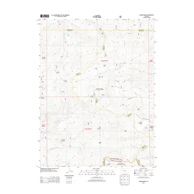
2013 Map of Quaker Mesa
USGS Topo · Published 2013About this map
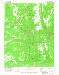
The high-altitude drainage systems of White River National Forest and Gunnison National Forest converge on this 2013 survey, where Mesa, Pitkin, and Gunnison counties meet. The landscape is defined by massive landforms such as Quaker Mesa and Flat Top Mountain, which rise between deep drainages like East Divide Creek and North Thompson Creek. Early 20th-century routes are preserved in the mapping, including Jones Creek Trail 1901.1 and Clearfork Trail 8810.0. Evidence of land management and resource extraction appears in features like the Thompson Cr Ditch, Reservoir Park, and the industrial footprint of Well No. 5 located near the eastern boundary. Notable landmarks such as Haystack Mountain and Baldy Mountain provide distinct navigational points within this complex network of creek systems including Beaver Dam Creek and Wolf Creek.
Find a feature on this map
54 named features on this map. Tap any name to fly to it.
Don’t see what you’re looking for? This feature index may not catch every label — zoom into the map to look around manually.
Map Details
Editions of this 2013 Quaker Mesa Map
This is the sole edition of this map. No revisions or reprints were ever made.
Other maps of this area

1957 · Leadville
USGS Topo · 1:250,000

1959 · Leadville
USGS Topo · 1:250,000

1960 · Leadville
USGS Topo · 1:250,000

1961 · Cattle Creek
USGS Topo · 1:24,000

1961 · Spruce Mountain
USGS Topo · 1:24,000

1962 · Leadville
USGS Topo · 1:250,000
1963 · Flatiron Mountain
USGS Topo · 1:24,000
1963 · Center Mountain
USGS Topo · 1:24,000
1963 · Placita
USGS Topo · 1:24,000
1963 · Stony Ridge
USGS Topo · 1:24,000