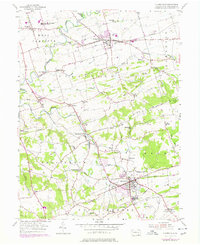
1955 Map of Quarryville
USGS Topo · Published 1978About this map
Quarryville serves as a major hub in this corner of Lancaster County, showing a concentration of industrial and civic features like Grain Storage Bins, the Quarryville Presbyterian Home, and the Ashland Sch. The landscape is defined by the winding course of Pequea Creek and its many tributaries, including Beaver Creek and Walnut Run. To the north, the borough of Strasburg is clearly defined, while smaller settlements like New Providence, Refton, and Hessdale dot the agricultural landscape.
Find a feature on this map
63 named features on this map. Tap any name to fly to it.
Don’t see what you’re looking for? This feature index may not catch every label — zoom into the map to look around manually.
Map Details
Editions of this 1955 Quarryville Map
4 editions found
Other maps of this area

1902 · Lancaster
USGS Topo · 1:62,500

1904 · Lancaster
USGS Topo · 1:62,500

1906 · New Holland
USGS Topo · 1:62,500

1908 · New Holland
USGS Topo · 1:62,500

1912 · Quarryville
USGS Topo · 1:62,500

1912 · Mc Calls Ferry
USGS Topo · 1:62,500

1941 · New Holland
USGS Topo · 1:62,500

1943 · Lancaster
USGS Topo · 1:62,500

1943 · Quarryville
USGS Topo · 1:62,500

1943 · Mc Calls Ferry
USGS Topo · 1:62,500
Featured Places
- West Lampeter Township, PA
- Willow Street, West Lampeter Township
- Paradise Township, PA
- Quarryville, PA
- Strasburg, PA