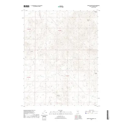
2018 Map of Quartz Mountain NW
USGS Topo · Published 2018About this map
Broken Hills anchors the southern portion of this high-desert Nevada landscape, where the terrain transitions toward the rugged East Gate Range in the northeast. The geography is defined by arid drainage patterns, most notably the seasonal Gabbs Wash that winds through the central valley. Small but vital water sources like Mud Spring are identified, hinting at the historical importance of such features for early travelers and prospectors in Churchill County. Distinctive geological landmarks including Iron Rock and the peak at Grayback provide navigational markers across this sparsely populated section of the Great Basin, which remained largely undeveloped into the early 21st century.
Find a feature on this map
10 named features on this map. Tap any name to fly to it.
Don’t see what you’re looking for? This feature index may not catch every label — zoom into the map to look around manually.
Map Details
Editions of this 2018 Quartz Mountain NW Map
This is the sole edition of this map. No revisions or reprints were ever made.
Other maps of this area

1908 · Carson Sink
USGS Topo · 1:250,000

1910 · Carson Sink
USGS Topo · 1:250,000

1955 · Millett
USGS Topo · 1:250,000

1957 · Reno
USGS Topo · 1:250,000

1959 · Reno
USGS Topo · 1:250,000

1959 · Millett
USGS Topo · 1:250,000

1960 · Reno
USGS Topo · 1:250,000
1969 · Quartz Mtn
USGS Topo · 1:24,000
1969 · Quartzite Mtn NW
USGS Topo · 1:24,000

1969 · Desatoya Peak
USGS Topo · 1:24,000