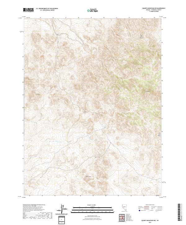
2021 Map of Quartz Mountain NW
USGS Topo · Published 2021About this map
The East Gate Range dominates the eastern margin of this Churchill County survey, providing a prominent geographic anchor in an area defined by desert elevations and drainage systems. Toward the southern extent of the range, the terrain reaches Grayback, while further south the land falls away toward the Broken Hills. These geological formations oversee a network of seasonal watercourses and occasional points of moisture, such as Mud Spring located near the center of the sheet.
Find a feature on this map
10 named features on this map. Tap any name to fly to it.
Don’t see what you’re looking for? This feature index may not catch every label — zoom into the map to look around manually.
Map Details
Editions of this 2021 Quartz Mountain NW Map
This is the sole edition of this map. No revisions or reprints were ever made.
Other maps of this area

1908 · Carson Sink
USGS Topo · 1:250,000

1910 · Carson Sink
USGS Topo · 1:250,000

1955 · Millett
USGS Topo · 1:250,000

1957 · Reno
USGS Topo · 1:250,000

1959 · Reno
USGS Topo · 1:250,000

1959 · Millett
USGS Topo · 1:250,000

1960 · Reno
USGS Topo · 1:250,000
1969 · Quartz Mtn
USGS Topo · 1:24,000
1969 · Quartzite Mtn NW
USGS Topo · 1:24,000

1969 · Desatoya Peak
USGS Topo · 1:24,000