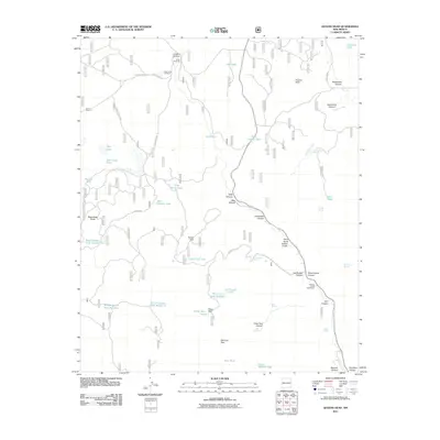
2011 Map of Queens Head
USGS Topo · Published 2011About this map
Apache Creek Deaf Ranch sits in the high canyons of Catron County, New Mexico, marking a unique institutional presence in this drainage-rich landscape. The terrain is defined by a dense network of steep drainages including Lee Russell Canyon, Sawmill Canyon, and Jewett Gap Canyon, where water management is central to the land's utility. Numerous named tanks and windmills, such as the Gann Windmill, Red Windmill, and Wild Horse Tank, demonstrate the infrastructure required for ranching and survival in this arid environment. Significant landmarks like Negrohead Butte and the distinctive Queens Head overlook large open areas like Turkey Park and Elk Horn Park. The inclusion of Schoolhouse Canyon suggests the historical presence of early rural education sites, while several springs like Mule Spring and Kerr Spring indicate vital natural water sources long utilized by local residents.
Find a feature on this map
56 named features on this map. Tap any name to fly to it.
Don’t see what you’re looking for? This feature index may not catch every label — zoom into the map to look around manually.
Map Details
Editions of this 2011 Queens Head Map
This is the sole edition of this map. No revisions or reprints were ever made.
Other maps of this area

1915 · Reserve
USGS Topo · 1:125,000

1918 · Reserve
USGS Topo · 1:125,000

1954 · Clifton
USGS Topo · 1:250,000

1954 · Saint Johns
USGS Topo · 1:250,000

1957 · Clifton
USGS Topo · 1:250,000

1957 · Saint Johns
USGS Topo · 1:250,000

1958 · Clifton
USGS Topo · 1:250,000

1958 · Saint Johns
USGS Topo · 1:250,000

1962 · Clifton
USGS Topo · 1:250,000

1962 · Saint Johns
USGS Topo · 1:250,000