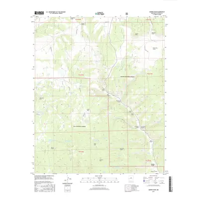
2017 Map of Queens Head
USGS Topo · Published 2017About this map
Queens Head stands as a prominent landmark in this high-altitude landscape where the Apache National Forest meets the Gila National Forest. The map reveals a complex network of seasonal water management and drainage, defined by numerous named features such as Fitzgerald Cienega and Dry Lake. The terrain is deeply incised by a series of significant canyons and gulches, including Hardcastle Canyon, Lee Russell Canyon, and Schoolhouse Canyon, which suggests a history of localized resource use and movement.
Find a feature on this map
63 named features on this map. Tap any name to fly to it.
Don’t see what you’re looking for? This feature index may not catch every label — zoom into the map to look around manually.
Map Details
Editions of this 2017 Queens Head Map
This is the sole edition of this map. No revisions or reprints were ever made.
Other maps of this area

1915 · Reserve
USGS Topo · 1:125,000

1918 · Reserve
USGS Topo · 1:125,000

1954 · Clifton
USGS Topo · 1:250,000

1954 · Saint Johns
USGS Topo · 1:250,000

1957 · Clifton
USGS Topo · 1:250,000

1957 · Saint Johns
USGS Topo · 1:250,000

1958 · Clifton
USGS Topo · 1:250,000

1958 · Saint Johns
USGS Topo · 1:250,000

1962 · Clifton
USGS Topo · 1:250,000

1962 · Saint Johns
USGS Topo · 1:250,000