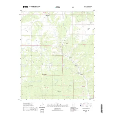
2020 Map of Queens Head
USGS Topo · Published 2020About this map
Apache National Forest and the Gila National Forest meet in this high-altitude landscape of western New Mexico, defined by a complex network of canyons and seasonal water sources. Significant topographic landmarks such as Queens Head and Negrohead Butte overlook a series of deep drainages, including Hardcastle Canyon and Jewett Gap Canyon. The scarcity of permanent water is reflected in the numerous man-made and natural catchments scattered throughout the terrain, such as Fitzgerald Cienega, Gann Tank, and Dry Lakes.
Find a feature on this map
54 named features on this map. Tap any name to fly to it.
Don’t see what you’re looking for? This feature index may not catch every label — zoom into the map to look around manually.
Map Details
Editions of this 2020 Queens Head Map
This is the sole edition of this map. No revisions or reprints were ever made.
Other maps of this area

1915 · Reserve
USGS Topo · 1:125,000

1918 · Reserve
USGS Topo · 1:125,000

1954 · Clifton
USGS Topo · 1:250,000

1954 · Saint Johns
USGS Topo · 1:250,000

1957 · Clifton
USGS Topo · 1:250,000

1957 · Saint Johns
USGS Topo · 1:250,000

1958 · Clifton
USGS Topo · 1:250,000

1958 · Saint Johns
USGS Topo · 1:250,000

1962 · Clifton
USGS Topo · 1:250,000

1962 · Saint Johns
USGS Topo · 1:250,000