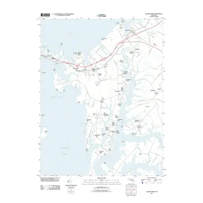
2011 Map of Queenstown
USGS Topo · Published 2011About this map
The intricate shoreline of the Chesapeake Bay's eastern reaches defines this landscape, where the Chester River meets the complex inlets of the Wye River and Prospect Bay. In this part of Queen Anne's County, maritime heritage is evident at Kent Island Narrows and Browns Landing, while the interior reflects a long history of land ownership through estates like East Prospect Plantation and the uniquely named My Lords Gift. The map documents established communities at Queenstown and Grasonville, both maintaining their own postal hubs. Institutional presence is noted at the University of Maryland - Wye Institute, situated near Cheston on the Wye. For genealogists, the map is a vital resource for locating family burial grounds, including Saint Peters Cemetery and several others such as Bryans Cemetery and Perrys Corner Cemetery, providing precise locations for these historical landmarks.
Find a feature on this map
98 named features on this map. Tap any name to fly to it.
Don’t see what you’re looking for? This feature index may not catch every label — zoom into the map to look around manually.
Map Details
Editions of this 2011 Queenstown Map
This is the sole edition of this map. No revisions or reprints were ever made.
Other maps of this area

1892 · Annapolis
USGS Topo · 1:62,500

1893 · North Point
USGS Topo · 1:62,500

1898 · Choptank
USGS Topo · 1:125,000

1898 · Tolchester
USGS Topo · 1:125,000

1901 · Chestertown
USGS Topo · 1:62,500

1903 · Tolchester
USGS Topo · 1:125,000

1904 · St. Michaels
USGS Topo · 1:62,500

1904 · North Point
USGS Topo · 1:62,500

1904 · Annapolis
USGS Topo · 1:62,500

1908 · Tolchester
USGS Topo · 1:125,000