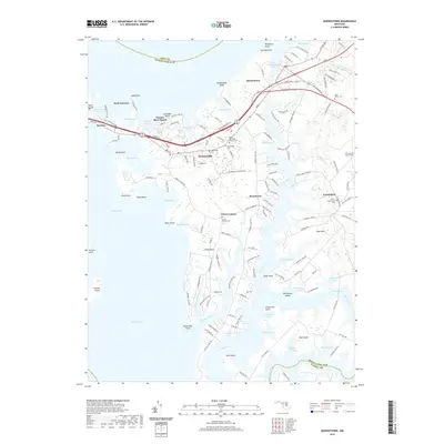
2019 Map of Queenstown
USGS Topo · Published 2019About this map
Grasonville and Queenstown anchor this detailed study of the Maryland Eastern Shore's intricate coastline. The landscape is defined by the complex branching of the Wye River and the expansive Prospect Bay, where the shoreline is punctuated by numerous family-named points and bluffs such as Blackbeards Bluff and Coursey Point. This geography historically dictated a boat-centered economy and remote settlement patterns that persist in the layout of contemporary roads like Bennett Point Rd and Grasonville Cemetery Rd.
Find a feature on this map
144 named features on this map. Tap any name to fly to it.
Don’t see what you’re looking for? This feature index may not catch every label — zoom into the map to look around manually.
Map Details
Editions of this 2019 Queenstown Map
This is the sole edition of this map. No revisions or reprints were ever made.
Other maps of this area

1892 · Annapolis
USGS Topo · 1:62,500

1893 · North Point
USGS Topo · 1:62,500

1898 · Choptank
USGS Topo · 1:125,000

1898 · Tolchester
USGS Topo · 1:125,000

1901 · Chestertown
USGS Topo · 1:62,500

1903 · Tolchester
USGS Topo · 1:125,000

1904 · St. Michaels
USGS Topo · 1:62,500

1904 · North Point
USGS Topo · 1:62,500

1904 · Annapolis
USGS Topo · 1:62,500

1908 · Tolchester
USGS Topo · 1:125,000