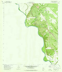
1974 Map of Quemado SE
USGS Topo · Published 1977About this map
The Rio Grande carves a sharp, serpentine international boundary between United States and Mexico in this South Texas borderland. The landscape is defined by the critical management of water in an arid environment, dominated by the engineered path of the Maverick County Canal. This infrastructure supports the local economy through features like the Pumping Sta, Filtration Plant, and Siphon, while Ditch No 15 and various laterals distribute the resource across the plain. Industrial and extractive activity is evident along the eastern ridges, where numerous Gravel Pit sites and a Mine are situated near U.S. Route 277. The presence of a Landing Strip and a Power Plant indicates a developing utility and transportation footprint along the river's edge, even as drainage features like Redondo Creek and Elm Creek continue to shape the natural topography.
Find a feature on this map
23 named features on this map. Tap any name to fly to it.
Don’t see what you’re looking for? This feature index may not catch every label — zoom into the map to look around manually.
Map Details
Editions of this 1974 Quemado SE Map
This is the sole edition of this map. No revisions or reprints were ever made.
Other maps of this area

1940 · Eagle Pass
USGS Topo · 1:62,500

1940 · Paloma
USGS Topo · 1:62,500

1940 · Quemado
USGS Topo · 1:62,500

1958 · Eagle Pass
USGS Topo · 1:250,000

1965 · Eagle Pass
USGS Topo · 1:250,000
1974 · Deadmans Hill
USGS Topo · 1:24,000
1974 · Paloma
USGS Topo · 1:24,000
1979 · Quemado West
USGS Topo · 1:24,000
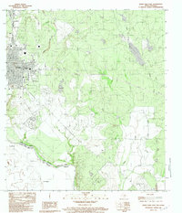
1983 · Eagle Pass East
USGS Topo · 1:24,000
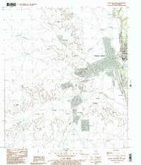
1983 · Eagle Pass West
USGS Topo · 1:24,000