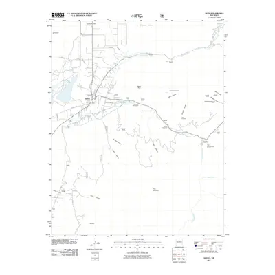
2011 Map of Questa
USGS Topo · Published 2011About this map
Questa serves as the central hub of this northern New Mexico landscape, situated where the Red River emerges from the high canyons to meet a complex network of irrigation works like the Llano Ditch, Embargo Ditch, and Sunshine Canal. The village’s civic and spiritual life is anchored by the Questa Post Office and the Saint Anthony Cemetery, while its industrial identity is defined by the massive Questa Molybdenum Mine and a constellation of mineral claims including the Hercules Group, Gray Hawk Prospect, and Silver Mine. To the south, the settlement of Lama rests near the mouth of Lama Canyon, marking a transition toward the steep terrain of Flag Mountain. This area is characterized by a dense concentration of mining history and high-altitude water management, with recreation sites like Eagle Rock Campground and Columbine Campground tucked into the dramatic folds of Peñasquito Canyon and Almagre Canyon.
Find a feature on this map
62 named features on this map. Tap any name to fly to it.
Don’t see what you’re looking for? This feature index may not catch every label — zoom into the map to look around manually.
Map Details
Editions of this 2011 Questa Map
This is the sole edition of this map. No revisions or reprints were ever made.
Other maps of this area

1954 · Raton
USGS Topo · 1:250,000

1958 · Raton
USGS Topo · 1:250,000

1963 · Wheeler Peak
USGS Topo · 1:24,000

1963 · Arroyo Seco
USGS Topo · 1:24,000

1963 · Arroyo Hondo
USGS Topo · 1:24,000

1963 · Cerro
USGS Topo · 1:24,000

1963 · Sunshine
USGS Topo · 1:24,000

1963 · Questa
USGS Topo · 1:24,000

1963 · Guadalupe Mountain
USGS Topo · 1:24,000

1963 · Latir Peak
USGS Topo · 1:24,000