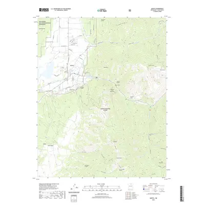
2020 Map of Questa
USGS Topo · Published 2020About this map
Questa serves as the focal point of this northern New Mexico landscape, situated where the high desert mesa meets the rising slopes of the Sangre de Cristo Mountains. The settlement pattern follows a network of local acequias and watercourses like the Sunshine Canal, Llano Ditch, and Embargo Ditch, illustrating the area's historical reliance on irrigation. To the east, the terrain ascends sharply into the Carson National Forest, characterized by numerous deep drainages such as Cabresto Canyon and Capulin Canyon. Genealogists may find interest in the documented locations of the Veterans Cem and Saint Anthony Cem. The map further details the transition from the community to the high-elevation wilderness, marking features such as Lobo Peak and the southern edge of the Río Grande del Norte National Monument.
Find a feature on this map
67 named features on this map. Tap any name to fly to it.
Don’t see what you’re looking for? This feature index may not catch every label — zoom into the map to look around manually.
Map Details
Editions of this 2020 Questa Map
This is the sole edition of this map. No revisions or reprints were ever made.
Other maps of this area

1954 · Raton
USGS Topo · 1:250,000

1958 · Raton
USGS Topo · 1:250,000

1963 · Wheeler Peak
USGS Topo · 1:24,000

1963 · Arroyo Seco
USGS Topo · 1:24,000

1963 · Arroyo Hondo
USGS Topo · 1:24,000

1963 · Cerro
USGS Topo · 1:24,000

1963 · Sunshine
USGS Topo · 1:24,000

1963 · Questa
USGS Topo · 1:24,000

1963 · Guadalupe Mountain
USGS Topo · 1:24,000

1963 · Latir Peak
USGS Topo · 1:24,000