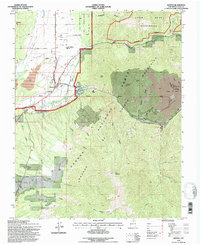
1995 Map of Questa
USGS Topo · Published 1997About this map
The Sangre De Cristo Mountains dominate the landscape in this mid-1990s revision of the northern New Mexico terrain. Industrial activity is prominently visible at the Questa Molybdenum Mine and a large Open Pit Mine situated near Sulphur Gulch on the eastern edge of the quadrangle. These operations contrast with the protected lands of the Carson National Forest and the Latir Peak Wilderness to the north.
Find a feature on this map
38 named features on this map. Tap any name to fly to it.
Don’t see what you’re looking for? This feature index may not catch every label — zoom into the map to look around manually.
Map Details
Editions of this 1995 Questa Map
This is the sole edition of this map. No revisions or reprints were ever made.
Other maps of this area

1954 · Raton
USGS Topo · 1:250,000

1958 · Raton
USGS Topo · 1:250,000

1963 · Wheeler Peak
USGS Topo · 1:24,000

1963 · Arroyo Seco
USGS Topo · 1:24,000

1963 · Arroyo Hondo
USGS Topo · 1:24,000

1963 · Cerro
USGS Topo · 1:24,000

1963 · Sunshine
USGS Topo · 1:24,000

1963 · Questa
USGS Topo · 1:24,000

1963 · Guadalupe Mountain
USGS Topo · 1:24,000

1963 · Latir Peak
USGS Topo · 1:24,000