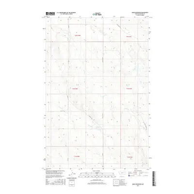
2017 Map of Quick Reservoir
USGS Topo · Published 2017About this map
Quick Reservoir and the drainage basins of the Missouri River plateau define this portion of McCone County. This landscape is shaped by the seasonal flow of intermittent streams, including Hell Cr, McCune Cr, and Dry Ash Cr, which carve through the high plains. The topography is dominated by the prominent elevation of Circle Tower Hill in the north, while the southern reaches drop toward Deep Bottom. The map reveals a sparse network of section-line roads and local routes like Union Rd and McCune Creek Rd that service large ranching tracts. Small-scale water management is evident at McCluys Reservoir, illustrating the vital role of gathered surface water in this arid prairie environment.
Find a feature on this map
18 named features on this map. Tap any name to fly to it.
Don’t see what you’re looking for? This feature index may not catch every label — zoom into the map to look around manually.
Map Details
Editions of this 2017 Quick Reservoir Map
This is the sole edition of this map. No revisions or reprints were ever made.
Other maps of this area

1954 · Glendive
USGS Topo · 1:250,000

1957 · Glendive
USGS Topo · 1:250,000

1958 · Glendive
USGS Topo · 1:250,000

1982 · Circle
USGS Topo · 1:100,000

1983 · Youngquist Mine
USGS Topo · 1:24,000

1983 · Woodworth Hill
USGS Topo · 1:24,000

1983 · Mount Antelope
USGS Topo · 1:24,000

1983 · Quick Reservoir
USGS Topo · 1:24,000

1983 · Circle
USGS Topo · 1:24,000
1983 · Bearshack Creek
USGS Topo · 1:24,000