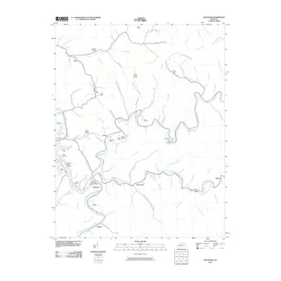
2010 Map of Quicksand
USGS Topo · Published 2010About this map
Quicksand and the surrounding coal-country settlements of the North Fork Kentucky River are depicted in this 2010 survey. The landscape is defined by its winding waterways and the high-elevation peaks of the Cumberland Plateau, featuring landmarks such as Pilot Knob and the Frozen Lookout Tower. The drainage patterns are intricate, with dozens of named branches like Meatscaffold Branch and Dumb Betty Branch feeding into Quicksand Creek and the river forks. Local history is preserved through numerous family burial sites, including the Bach Cemetery, Williams Cemetery, and Turner Cemetery. Scientific and transportation infrastructure is well-represented, from the University of Kentucky Experimental Farm to the Julian Carroll Airport. This area shows the intersection of deep-rooted Appalachian communities like Portsmouth, Noctor, and Kragon with the complex terrain that has shaped their development for generations.
Find a feature on this map
91 named features on this map. Tap any name to fly to it.
Don’t see what you’re looking for? This feature index may not catch every label — zoom into the map to look around manually.
Map Details
Editions of this 2010 Quicksand Map
This is the sole edition of this map. No revisions or reprints were ever made.
Other maps of this area

1889 · Salyersville
USGS Topo · 1:125,000

1891 · Hazard
USGS Topo · 1:125,000

1891 · Salyersville
USGS Topo · 1:125,000

1899 · Salyersville
USGS Topo · 1:125,000

1913 · Buckhorn
USGS Topo · 1:62,500

1914 · Troublesome
USGS Topo · 1:62,500

1951 · Guage
USGS Topo · 1:24,000

1951 · Landsaw
USGS Topo · 1:24,000

1951 · Seitz
USGS Topo · 1:24,000

1951 · Quicksand
USGS Topo · 1:24,000