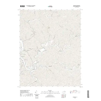
2019 Map of Quicksand
USGS Topo · Published 2019About this map
Quicksand Creek and its many winding tributaries define the complex geography of this Breathitt County landscape. The settlement of Quicksand sits at the heart of a region where narrow hollows and steep ridges dictated the placement of small communities and family landmarks. The map records several legacy burial sites, including Snowden Cem and Brewer Cem near the town of Jackson, as well as Turner Cem further south. These sites, along with the Julian Carroll Airport situated on a high plateau, reflect the area's mix of traditional settlement patterns and modern infrastructure.
Find a feature on this map
107 named features on this map. Tap any name to fly to it.
Don’t see what you’re looking for? This feature index may not catch every label — zoom into the map to look around manually.
Map Details
Editions of this 2019 Quicksand Map
This is the sole edition of this map. No revisions or reprints were ever made.
Other maps of this area

1889 · Salyersville
USGS Topo · 1:125,000

1891 · Hazard
USGS Topo · 1:125,000

1891 · Salyersville
USGS Topo · 1:125,000

1899 · Salyersville
USGS Topo · 1:125,000

1913 · Buckhorn
USGS Topo · 1:62,500

1914 · Troublesome
USGS Topo · 1:62,500

1951 · Guage
USGS Topo · 1:24,000

1951 · Landsaw
USGS Topo · 1:24,000

1951 · Seitz
USGS Topo · 1:24,000

1951 · Quicksand
USGS Topo · 1:24,000