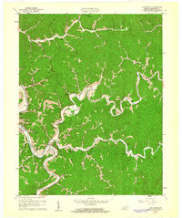
1961 Map of Quicksand
USGS Topo · Published 1961About this map
The North Fork Kentucky River and Kentucky River dominate the landscape of this Breathitt County survey, where the winding waters dictate the location of roads and rail. The Louisville and Nashville railroad tracks follow the river's path, connecting riverside settlements like Quicksand and Noctor. Significant land use is marked by the Univ of Kentucky Experimental Farm, nestled in a deep river bend. The region's social geography is anchored by numerous small congregations and missions, including the Emanuel Memorial Chapel, Rehoboth Mtn Mission, and Grace Chapel. Higher elevations like Pilot Knob and Bald Hill rise above a dense network of hollows and branches, such as Shucky Bean Hol and Betty Branch. This map documents a rural landscape where family names—seen on sites like the Williams Hill Cem and Hardin Cem—remain deeply tied to the specific topography of the Cumberland Plateau.
Find a feature on this map
95 named features on this map. Tap any name to fly to it.
Don’t see what you’re looking for? This feature index may not catch every label — zoom into the map to look around manually.
Map Details
Editions of this 1961 Quicksand Map
This is the sole edition of this map. No revisions or reprints were ever made.
Other maps of this area

1889 · Salyersville
USGS Topo · 1:125,000

1891 · Hazard
USGS Topo · 1:125,000

1891 · Salyersville
USGS Topo · 1:125,000

1899 · Salyersville
USGS Topo · 1:125,000

1913 · Buckhorn
USGS Topo · 1:62,500

1914 · Troublesome
USGS Topo · 1:62,500

1951 · Guage
USGS Topo · 1:24,000

1951 · Landsaw
USGS Topo · 1:24,000

1951 · Seitz
USGS Topo · 1:24,000

1951 · Quicksand
USGS Topo · 1:24,000