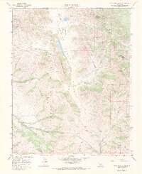
1968 Map of Quien Sabe Valley
USGS Topo · Published 1971About this map
Quien Sabe Valley and the Santa Ana Mountains dominate this California landscape, where agricultural life centers around established landmarks like Quien Sabe Ranch and Buena Vista Ranch. The map illustrates a region defined by its water resources and complex topography, featuring a network of drainage that includes Quien Sabe Creek and Santa Ana Creek, as well as numerous springs and wells essential for ranching operations. The presence of a Landing Strip near the valley floor suggests the importance of aerial accessibility for these remote rural outposts.
Find a feature on this map
27 named features on this map. Tap any name to fly to it.
Don’t see what you’re looking for? This feature index may not catch every label — zoom into the map to look around manually.
Map Details
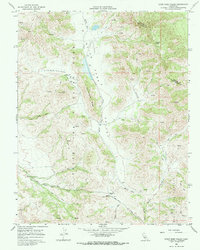
Editions of this 1968 Quien Sabe Valley Map
2 editions found
Other maps of this area

1919 · San Benito
USGS Topo · 1:62,500

1919 · Hollister
USGS Topo · 1:48,000

1921 · Gonzales
USGS Topo · 1:62,500

1921 · Hollister
USGS Topo · 1:62,500

1922 · Quien Sabe
USGS Topo · 1:62,500

1923 · Hollister
USGS Topo · 1:62,500

1931 · San Benito
USGS Topo · 1:62,500

1940 · Hollister
USGS Topo · 1:62,500

1940 · Quien Sabe
USGS Topo · 1:62,500

1940 · San Benito
USGS Topo · 1:62,500