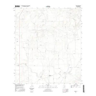
2016 Map of Quihi
USGS Topo · Published 2016About this map
New Fountain serves as the focal point for this rural Medina County landscape, situated near the intersection of several local routes. The terrain is defined by a dense network of seasonal drainages, including Verde Cr, Second Cr, and Quihi Cr, which carve through the territory. This map is particularly valuable for genealogical research, as it identifies several family-named and local burial sites such as Decker Cem, Britsch Cem, and Saint Johns Cem. The settlement pattern is largely dictated by the watercourses and an extensive grid of country roads, including Co RD 251 and Co RD 351. In the northwest, Haass Field stands as a notable landmark amidst the undulating contours. The transition between the higher elevations and the creek beds illustrates the traditional land use patterns of this Texas Hill Country region.
Find a feature on this map
53 named features on this map. Tap any name to fly to it.
Don’t see what you’re looking for? This feature index may not catch every label — zoom into the map to look around manually.
Map Details
Editions of this 2016 Quihi Map
This is the sole edition of this map. No revisions or reprints were ever made.
Other maps of this area

1954 · San Antonio
USGS Topo · 1:250,000

1956 · New Fountain
USGS Topo · 1:62,500

1956 · Bandera
USGS Topo · 1:62,500

1956 · Medina Lake
USGS Topo · 1:62,500

1957 · San Antonio
USGS Topo · 1:250,000

1964 · Riomedina
USGS Topo · 1:24,000

1964 · Castroville
USGS Topo · 1:24,000

1964 · Timber Creek
USGS Topo · 1:24,000

1964 · Medina Lake
USGS Topo · 1:24,000
1969 · Twin Hollow
USGS Topo · 1:24,000