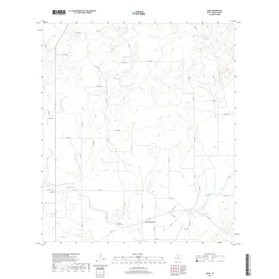
2019 Map of Quihi
USGS Topo · Published 2019About this map
New Fountain serves as a focal point in this portion of Medina County, where a network of rural county roads and private lanes crisscross a landscape defined by an intricate drainage system. Numerous watercourses, including Verde Cr, Second Cr, and First Cr, move southward through the terrain toward Hondo Cr. This topography, characterized by the convergence of several small streams like Bull Cr and Polecat Cr, has historically influenced the placement of local burial grounds and early farmsteads. Genealogists will find several notable local landmarks, such as Saint Johns Cem near the town center, along with the Britsch Cem, Decker Cem, and Quihi Cem, which provide tangible links to the area's early family history and heritage. The inclusion of Haass Field further illustrates the agricultural and aviation character of this rural Texas landscape.
Find a feature on this map
53 named features on this map. Tap any name to fly to it.
Don’t see what you’re looking for? This feature index may not catch every label — zoom into the map to look around manually.
Map Details
Editions of this 2019 Quihi Map
This is the sole edition of this map. No revisions or reprints were ever made.
Other maps of this area

1954 · San Antonio
USGS Topo · 1:250,000

1956 · New Fountain
USGS Topo · 1:62,500

1956 · Bandera
USGS Topo · 1:62,500

1956 · Medina Lake
USGS Topo · 1:62,500

1957 · San Antonio
USGS Topo · 1:250,000

1964 · Riomedina
USGS Topo · 1:24,000

1964 · Castroville
USGS Topo · 1:24,000

1964 · Timber Creek
USGS Topo · 1:24,000

1964 · Medina Lake
USGS Topo · 1:24,000
1969 · Twin Hollow
USGS Topo · 1:24,000