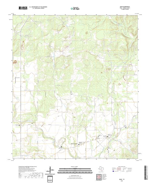
2022 Map of Quihi
USGS Topo · Published 2022About this map
New Fountain serves as a central hub in this part of Medina County, where the landscape is defined by the branching tributaries of the Hondo Cr and Quihi Cr. This area preserves a dense concentration of local genealogical sites, reflecting a heritage tied to early settlements and family homesteads. The map illustrates a rural network of county roads connecting numerous burial grounds, from church-affiliated sites like the Bethlehem Lutheran Cem and Saint Johns Lutheran Cem to smaller, private locations such as the Beiten Family Cem and Schweers Family Cem. The terrain features several significant drainages including Verde Cr, Hexa Cr, and Elm Cr, which weave through the agricultural and ranching lands. These watercourses and named locations like Haass Field indicate a long-standing reliance on the local creek system for settlement patterns and land use in this Texas region.
Find a feature on this map
57 named features on this map. Tap any name to fly to it.
Don’t see what you’re looking for? This feature index may not catch every label — zoom into the map to look around manually.
Map Details
Editions of this 2022 Quihi Map
This is the sole edition of this map. No revisions or reprints were ever made.
Other maps of this area

1954 · San Antonio
USGS Topo · 1:250,000

1956 · New Fountain
USGS Topo · 1:62,500

1956 · Bandera
USGS Topo · 1:62,500

1956 · Medina Lake
USGS Topo · 1:62,500

1957 · San Antonio
USGS Topo · 1:250,000

1964 · Riomedina
USGS Topo · 1:24,000

1964 · Castroville
USGS Topo · 1:24,000

1964 · Timber Creek
USGS Topo · 1:24,000

1964 · Medina Lake
USGS Topo · 1:24,000
1969 · Twin Hollow
USGS Topo · 1:24,000