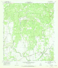
1969 Map of Quihi
USGS Topo · Published 1972About this map
Quihi and New Fountain anchor this agricultural region of Medina County, where German-Texan heritage is evident in the cluster of family and community burial grounds. Several historic cemeteries, including Britsch Cem., Decker Cem, St Johns Cem, and Quihi Cem, are mapped near the winding courses of Verde Creek and Hondo Creek. The landscape is defined by a dense network of seasonal drainages, such as First Creek, Second Creek, and Hexa Creek, which flow southward through the undulating terrain near Heyen.
Find a feature on this map
21 named features on this map. Tap any name to fly to it.
Don’t see what you’re looking for? This feature index may not catch every label — zoom into the map to look around manually.
Map Details
Editions of this 1969 Quihi Map
2 editions found
Other maps of this area

1954 · San Antonio
USGS Topo · 1:250,000

1956 · New Fountain
USGS Topo · 1:62,500

1956 · Bandera
USGS Topo · 1:62,500

1956 · Medina Lake
USGS Topo · 1:62,500

1957 · San Antonio
USGS Topo · 1:250,000

1964 · Riomedina
USGS Topo · 1:24,000

1964 · Castroville
USGS Topo · 1:24,000

1964 · Timber Creek
USGS Topo · 1:24,000

1964 · Medina Lake
USGS Topo · 1:24,000
1969 · Twin Hollow
USGS Topo · 1:24,000