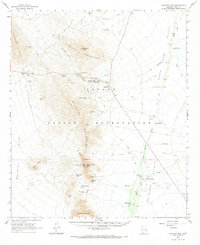
1963 Map of Quijotoa Mts
USGS Topo · Published 1969About this map
The Papago Indian Reservation dominates this 1960s landscape, revealing a network of desert settlements and extractive industries in the Sonoran environment. The high peaks of the Quijotoa Mountains and Brownell Mountains are dotted with historic mining sites like the Weldon Mine, Black Prince Mine, and the Ben Lomond Mines. Small communities and outposts such as Maish Vaya (Covered Wells) and the Quijotoa Trading Post serve as focal points along the valley floors.
Find a feature on this map
48 named features on this map. Tap any name to fly to it.
Don’t see what you’re looking for? This feature index may not catch every label — zoom into the map to look around manually.
Map Details
Editions of this 1963 Quijotoa Mts Map
2 editions found

Other maps of this area

1934 · Silver Bell
USGS Topo · 1:125,000

1937 · Comobabi
USGS Topo · 1:48,000

1941 · Sells
USGS Topo · 1:62,500

1942 · Comobabi
USGS Topo · 1:62,500

1943 · Sells
USGS Topo · 1:62,500

1943 · Fresnal
USGS Topo · 1:125,000

1953 · Ajo
USGS Topo · 1:250,000

1954 · Sonoyta
USGS Topo · 1:250,000

1956 · Nogales
USGS Topo · 1:250,000

1956 · Tucson
USGS Topo · 1:250,000
Featured Places
- Kaihon Kug, Sells
- Maish Vaya, Gu Achi District
- Kui Tatk, Sells
- Narcho Santos, Gu Achi District
- Piato Vaya, Pisinemo District