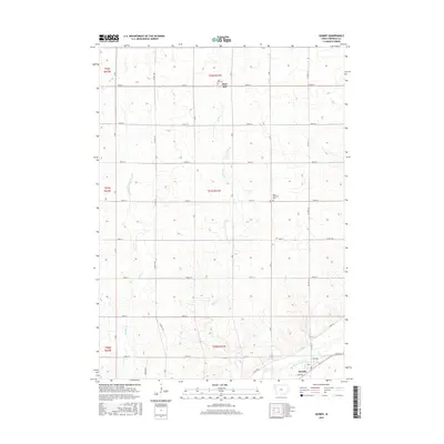
2015 Map of Quimby
USGS Topo · Published 2015About this map
Quimby sits in the southeastern corner of this Cherokee County survey, where the Little Sioux River cuts through the Iowa landscape. The town’s grid is clearly defined, including local streets like Clark Ave and E 4th Ave. Away from the river valley, the terrain is shaped by the drainage of Rock Cr and Willow Cr, flowing through a strictly organized section-line road network. This rural structure is dotted with local heritage sites, most notably the elevated Mary Hill and its associated Mary Hill Cem to the north. Further east, the Rock Township Cem serves as a silent landmark within the agricultural expanse. The map illustrates the persistent intersection of natural drainage and modern infrastructure, shown through the network of county highways such as Co Hwy L40 and Co Hwy L56 that connect these dispersed family and community sites.
Find a feature on this map
34 named features on this map. Tap any name to fly to it.
Don’t see what you’re looking for? This feature index may not catch every label — zoom into the map to look around manually.
Map Details
Editions of this 2015 Quimby Map
This is the sole edition of this map. No revisions or reprints were ever made.
Other maps of this area

1954 · Fort Dodge
USGS Topo · 1:250,000

1957 · Fort Dodge
USGS Topo · 1:250,000

1958 · Fort Dodge
USGS Topo · 1:250,000

1969 · Pierson
USGS Topo · 1:24,000

1969 · Cleghorn
USGS Topo · 1:24,000

1969 · Fielding
USGS Topo · 1:24,000
1969 · Marcus
USGS Topo · 1:24,000

1969 · Cherokee South
USGS Topo · 1:24,000

1969 · Quimby SE
USGS Topo · 1:24,000
1969 · Washta
USGS Topo · 1:24,000