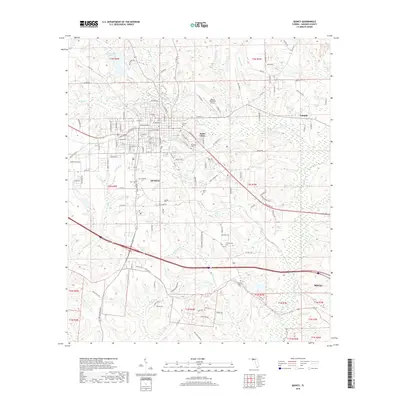
2018 Map of Quincy
USGS Topo · Published 2018About this map
Quincy serves as the focal point of this North Florida landscape, where a dense grid of streets including W King St and E Jefferson St meets the rural outskirts of Gadsden County. The area is defined by a network of small watercourses like Quincy Creek and Tanyard Br that carve through the terrain, historically influencing the placement of settlements and transport routes. Several small communities and neighborhoods appear on the periphery, including Santa Clara, Midway, and Littman.
Find a feature on this map
131 named features on this map. Tap any name to fly to it.
Don’t see what you’re looking for? This feature index may not catch every label — zoom into the map to look around manually.
Map Details
Editions of this 2018 Quincy Map
This is the sole edition of this map. No revisions or reprints were ever made.
Other maps of this area

1940 · Tallahassee
USGS Topo · 1:62,500

1942 · Tallahassee
USGS Topo · 1:62,500

1943 · Tallahassee
USGS Topo · 1:62,500

1943 · Lake Talquin
USGS Topo · 1:62,500

1954 · Tallahassee
USGS Topo · 1:250,000

1955 · Mt Pleasant
USGS Topo · 1:24,000

1956 · Havana North
USGS Topo · 1:24,000

1956 · Dogtown
USGS Topo · 1:24,000

1959 · Tallahassee
USGS Topo · 1:250,000

1959 · Gretna
USGS Topo · 1:24,000