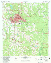
1982 Map of Quincy
USGS Topo · Published 1983About this map
The city of Quincy serves as the central hub of this Gadsden County survey, showcasing a landscape defined by its early 1980s infrastructure and the historical Forbes Purchase Line. Transportation and industry are prominent, with the Seaboard Coast Line Railroad cutting through the terrain and several extraction sites like the Strip Mine and various Claypit labels indicating local economic activity. The map reveals a dense network of civic life, from the Courthouse and City Hall to numerous educational institutions like Shanks High Sch and Parrimore High Sch.
Find a feature on this map
61 named features on this map. Tap any name to fly to it.
Don’t see what you’re looking for? This feature index may not catch every label — zoom into the map to look around manually.
Map Details
Editions of this 1982 Quincy Map
This is the sole edition of this map. No revisions or reprints were ever made.
Other maps of this area

1940 · Tallahassee
USGS Topo · 1:62,500

1942 · Tallahassee
USGS Topo · 1:62,500

1943 · Tallahassee
USGS Topo · 1:62,500

1943 · Lake Talquin
USGS Topo · 1:62,500

1954 · Tallahassee
USGS Topo · 1:250,000

1955 · Mt Pleasant
USGS Topo · 1:24,000

1956 · Havana North
USGS Topo · 1:24,000

1956 · Dogtown
USGS Topo · 1:24,000

1959 · Tallahassee
USGS Topo · 1:250,000

1959 · Gretna
USGS Topo · 1:24,000