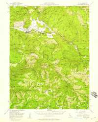
1951 Map of Quincy
USGS Topo · Published 1958About this map
Quincy and East Quincy anchor the American Valley at a time when the region's mining and timber foundations remained clearly visible. The Western Pacific Railroad snakes through the high country, connecting remote outposts like Spring Garden to the county seat. This mid-century survey captures a landscape transitioning from the gold-rush era to a modern resource economy, evidenced by the numerous small-scale mining operations and "site" labels for once-populated camps.
Find a feature on this map
112 named features on this map. Tap any name to fly to it.
Don’t see what you’re looking for? This feature index may not catch every label — zoom into the map to look around manually.
Map Details
Editions of this 1951 Quincy Map
3 editions found
Other maps of this area

1886 · Honey Lake
USGS Topo · 1:250,000

1886 · Lassen Peak
USGS Topo · 1:250,000

1888 · Bidwell Bar
USGS Topo · 1:125,000

1891 · Bidwell Bar
USGS Topo · 1:125,000

1891 · Downieville
USGS Topo · 1:125,000

1891 · Honey Lake
USGS Topo · 1:250,000

1892 · Lassen Peak
USGS Topo · 1:250,000

1893 · Bidwell Bar
USGS Topo · 1:125,000

1893 · Honey Lake
USGS Topo · 1:250,000

1893 · Downieville
USGS Topo · 1:125,000