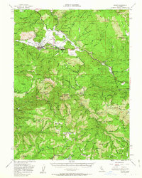
1951 Map of Quincy
USGS Topo · Published 1963About this map
American Valley serves as the primary hub of this northern California landscape, centered on the bustling community of Quincy and its nearby neighbor, East Quincy. The local economy of the early 1950s is deeply rooted in resource extraction and transportation, evidenced by the Western Pacific Railroad winding through the terrain and the numerous industrial sites such as the Cedar Mill. Civic life is anchored by the County Hospital and Pioneer Sch, while local history is preserved at the Indian Cem and County Cem.
Find a feature on this map
111 named features on this map. Tap any name to fly to it.
Don’t see what you’re looking for? This feature index may not catch every label — zoom into the map to look around manually.
Map Details
Editions of this 1951 Quincy Map
3 editions found
Other maps of this area

1886 · Honey Lake
USGS Topo · 1:250,000

1886 · Lassen Peak
USGS Topo · 1:250,000

1888 · Bidwell Bar
USGS Topo · 1:125,000

1891 · Bidwell Bar
USGS Topo · 1:125,000

1891 · Downieville
USGS Topo · 1:125,000

1891 · Honey Lake
USGS Topo · 1:250,000

1892 · Lassen Peak
USGS Topo · 1:250,000

1893 · Bidwell Bar
USGS Topo · 1:125,000

1893 · Honey Lake
USGS Topo · 1:250,000

1893 · Downieville
USGS Topo · 1:125,000