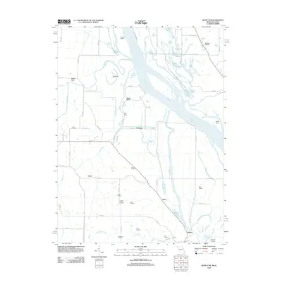
2012 Map of Quincy SW
USGS Topo · Published 2012About this map
The Mississippi River valley north of Hannibal dominates this 2012 survey, revealing a landscape defined by complex hydrology and family history. The river's path is marked by a network of chutes and backwaters, including Texas Chute, Eastern Slough, and the Rock Ridge Slough, which frame numerous islands like Fabius Island and Bay Island. On the Missouri side, the South River Levee stands as a critical piece of infrastructure, protecting the low-lying agricultural lands and small settlements like Huiskamp and Helton from the seasonal fluctuations of the river system.
Find a feature on this map
82 named features on this map. Tap any name to fly to it.
Don’t see what you’re looking for? This feature index may not catch every label — zoom into the map to look around manually.
Map Details
Editions of this 2012 Quincy SW Map
This is the sole edition of this map. No revisions or reprints were ever made.
Other maps of this area

1903 · Palmyra
USGS Topo · 1:125,000

1925 · Quincy
USGS Topo · 1:62,500

1932 · Hannibal
USGS Topo · 1:62,500

1936 · Hannibal
USGS Topo · 1:48,000

1944 · Quincy
USGS Topo · 1:62,500

1945 · Hannibal
USGS Topo · 1:62,500

1945 · Quincy
USGS Topo · 1:62,500

1948 · Quincy
USGS Topo · 1:250,000

1949 · Maywood
USGS Topo · 1:24,000

1949 · Palmyra
USGS Topo · 1:24,000