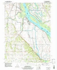
1996 Map of Quincy SW
USGS Topo · Published 1998About this map
The Mississippi River creates a complex landscape of islands and sloughs along the Missouri-Illinois border, where the Burlington Northern line runs parallel to the water. This 1990s composite reveals a riverfront defined by agricultural levee systems and small riverside stops like Huiskamp and Helton. The terrain transitions from the wide floodplain of the Bay De Charles and Heather Bay to the rising bluffs further west, where dozens of family burial grounds and country churches are scattered across the hills.
Find a feature on this map
42 named features on this map. Tap any name to fly to it.
Don’t see what you’re looking for? This feature index may not catch every label — zoom into the map to look around manually.
Map Details
Editions of this 1996 Quincy SW Map
This is the sole edition of this map. No revisions or reprints were ever made.
Other maps of this area

1903 · Palmyra
USGS Topo · 1:125,000

1925 · Quincy
USGS Topo · 1:62,500

1932 · Hannibal
USGS Topo · 1:62,500

1936 · Hannibal
USGS Topo · 1:48,000

1944 · Quincy
USGS Topo · 1:62,500

1945 · Hannibal
USGS Topo · 1:62,500

1945 · Quincy
USGS Topo · 1:62,500

1948 · Quincy
USGS Topo · 1:250,000

1949 · Maywood
USGS Topo · 1:24,000

1949 · Palmyra
USGS Topo · 1:24,000