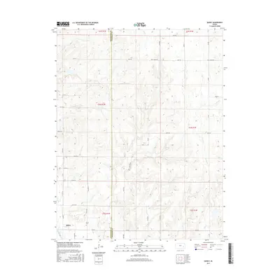
2015 Map of Quincy
USGS Topo · Published 2015About this map
The settlement of Quincy anchors this southeastern Kansas landscape, where the prairie transitions into a network of creek drainages along the border of Greenwood and Woodson Counties. This mid-2010s survey reveals a deeply rural character defined by section-line roads like Virgil Vernon Rd and 110th Rd, which navigate the undulating terrain between various watercourses. The local history of the area is centered at the Quincy Cem, located just east of the primary townsite. Hydrology plays a central role in the geography here, with the Verdigris River cutting through the southwestern corner, while numerous tributaries including Turkey Creek, Owl Creek, and Brazil Creek carve paths through the surrounding rangeland. The map illustrates a traditional Midwestern land pattern of township and range divisions, such as t24s r13e, where agriculture and open space remain the dominant features.
Find a feature on this map
33 named features on this map. Tap any name to fly to it.
Don’t see what you’re looking for? This feature index may not catch every label — zoom into the map to look around manually.
Map Details
Editions of this 2015 Quincy Map
This is the sole edition of this map. No revisions or reprints were ever made.
Other maps of this area

1885 · Burlington
USGS Topo · 1:125,000

1885 · Eureka
USGS Topo · 1:125,000

1886 · Fredonia
USGS Topo · 1:125,000

1888 · Emporia
USGS Topo · 1:125,000

1888 · Eureka
USGS Topo · 1:125,000

1894 · Emporia
USGS Topo · 1:125,000

1894 · Fredonia
USGS Topo · 1:125,000

1894 · Burlington
USGS Topo · 1:125,000

1894 · Eureka
USGS Topo · 1:125,000

1947 · Lawrence
USGS Topo · 1:250,000