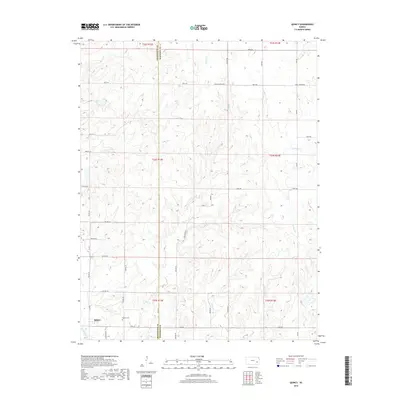
2018 Map of Quincy
USGS Topo · Published 2018About this map
Quincy serves as the primary settlement on this landscape, located in the southwestern corner where the terrain begins to slope toward the Verdigris River. The area is defined by a dense network of drainage systems, including Brazil Cr, Turkey Cr, and S Big Cr, which carve through the plains of Greenwood and Woodson counties. This late-stage topographic survey reveals a rural infrastructure reliant on a grid of township roads such as 190th Rd and Virgil Vernon Rd, connecting isolated farmsteads across the county line.
Find a feature on this map
32 named features on this map. Tap any name to fly to it.
Don’t see what you’re looking for? This feature index may not catch every label — zoom into the map to look around manually.
Map Details
Editions of this 2018 Quincy Map
This is the sole edition of this map. No revisions or reprints were ever made.
Other maps of this area

1885 · Burlington
USGS Topo · 1:125,000

1885 · Eureka
USGS Topo · 1:125,000

1886 · Fredonia
USGS Topo · 1:125,000

1888 · Emporia
USGS Topo · 1:125,000

1888 · Eureka
USGS Topo · 1:125,000

1894 · Emporia
USGS Topo · 1:125,000

1894 · Fredonia
USGS Topo · 1:125,000

1894 · Burlington
USGS Topo · 1:125,000

1894 · Eureka
USGS Topo · 1:125,000

1947 · Lawrence
USGS Topo · 1:250,000