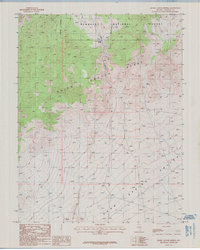
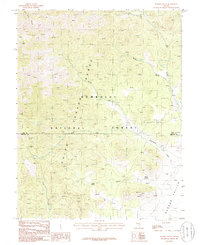
1985 Map of Quinn Canyon Springs
USGS Topo · Published 1986About this map
Quinn Canyon Range dominates this mid-1980s landscape, where steep high-desert elevations meet the broad expanse of Sand Spring Valley. The area is defined by its critical water sources, including the namesake Quinn Canyon Springs, McCutchen Spring, and Mud Spring, which have historically served as vital life-lines for livestock and prospectors in this arid Lincoln County interior. Mapping reveals a remote section of the Humboldt National Forest, characterized by complex topography and narrow drainages like Little Quinn Canyon. A single Prospect label indicates the localized search for minerals that drew early interest to these canyons, while an Indefinite Boundary suggests the challenges of surveying such isolated and difficult terrain prior to modern satellite precision.
Find a feature on this map
10 named features on this map. Tap any name to fly to it.
Don’t see what you’re looking for? This feature index may not catch every label — zoom into the map to look around manually.
Map Details
Editions of this 1985 Quinn Canyon Springs Map
This is the sole edition of this map. No revisions or reprints were ever made.
Other maps of this area

1942 · Penoyer Valley
USGS Topo · 1:125,000

1954 · Caliente
USGS Topo · 1:250,000

1956 · Lund
USGS Topo · 1:250,000

1959 · Caliente
USGS Topo · 1:250,000

1960 · Lund
USGS Topo · 1:250,000
1985 · Eds Well
USGS Topo · 1:24,000

1985 · McCutchen Spring
USGS Topo · 1:24,000
1985 · Goat Ranch Springs
USGS Topo · 1:24,000
1985 · Black Top
USGS Topo · 1:24,000
1985 · Badger Gulch
USGS Topo · 1:24,000