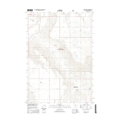
2015 Map of Quinn Table
USGS Topo · Published 2015About this map
Buffalo Gap National Grassland and Badlands National Park meet in this portion of South Dakota, where the high prairie begins its dramatic descent into the dissected breaks. The landscape is defined by the sharp transition between the level expanse of Brennan Flat and the namesake Quinn Table, a prominent plateau overlooking the winding course of the Cheyenne River. These features represent the classic topography of the region, where erosion has carved out a complex network of drainages including Sage Cr, S Fork Crooked Cr, and Dry Cr. The map reveals a sparse but deliberate road network, with routes like Sage Creek Rd and Sandy Flat Rd navigating the varying elevations. This documentation of the terrain at the edge of the badlands serves as a critical reference for understanding the intersection of federal lands and the unique geology near White Butte.
Find a feature on this map
22 named features on this map. Tap any name to fly to it.
Don’t see what you’re looking for? This feature index may not catch every label — zoom into the map to look around manually.
Map Details
Editions of this 2015 Quinn Table Map
This is the sole edition of this map. No revisions or reprints were ever made.
Other maps of this area

1953 · Rapid City
USGS Topo · 1:250,000

1954 · Wasta SE
USGS Topo · 1:24,000

1954 · Scenic
USGS Topo · 1:24,000

1954 · Wasta
USGS Topo · 1:24,000

1954 · Owanka
USGS Topo · 1:24,000

1954 · Brennan Flat
USGS Topo · 1:24,000

1954 · Quinn Table
USGS Topo · 1:24,000

1955 · Hot Springs
USGS Topo · 1:250,000

1957 · Rapid City
USGS Topo · 1:250,000

1960 · Quinn Table NE
USGS Topo · 1:24,000