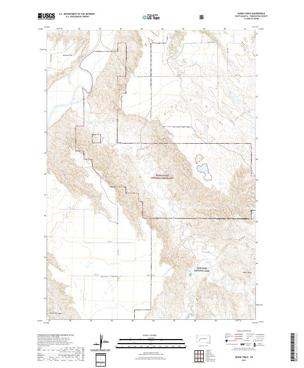
2021 Map of Quinn Table
USGS Topo · Published 2021About this map
Quinn Table and Seventyone Table dominate this Pennington County landscape, where the high plains of South Dakota transition into the intricate drainage patterns of the Badlands. This 2021 survey illustrates the confluence of protected public lands, where Buffalo Gap National Grassland meets the northern reaches of Badlands National Park. The topography is defined by sharp elevation changes, particularly around White Butte and the various draws feeding into the Cheyenne River.
Find a feature on this map
29 named features on this map. Tap any name to fly to it.
Don’t see what you’re looking for? This feature index may not catch every label — zoom into the map to look around manually.
Map Details
Editions of this 2021 Quinn Table Map
This is the sole edition of this map. No revisions or reprints were ever made.
Other maps of this area

1953 · Rapid City
USGS Topo · 1:250,000

1954 · Wasta SE
USGS Topo · 1:24,000

1954 · Scenic
USGS Topo · 1:24,000

1954 · Wasta
USGS Topo · 1:24,000

1954 · Owanka
USGS Topo · 1:24,000

1954 · Brennan Flat
USGS Topo · 1:24,000

1954 · Quinn Table
USGS Topo · 1:24,000

1955 · Hot Springs
USGS Topo · 1:250,000

1957 · Rapid City
USGS Topo · 1:250,000

1960 · Quinn Table NE
USGS Topo · 1:24,000