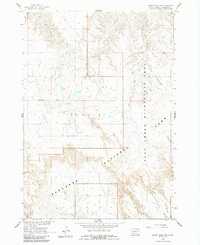
1960 Map of Quinn Table SW
USGS Topo · Published 1985About this map
The high plateau of Quinn Table dominates this 1960s landscape, illustrating the dramatic transition from flat-topped tablelands to the dissected breaks of the Badlands National Park. This survey captures the region as part of a post-war effort for the development of the Missouri River Basin, documenting a sparse ranching and grazing frontier where rural education was still anchored by local landmarks like the Jobgen Sch.
Find a feature on this map
9 named features on this map. Tap any name to fly to it.
Don’t see what you’re looking for? This feature index may not catch every label — zoom into the map to look around manually.
Map Details
Editions of this 1960 Quinn Table SW Map
2 editions found
Other maps of this area

1950 · Sheep Mountain Table
USGS Topo · 1:24,000

1950 · Imlay
USGS Topo · 1:24,000

1950 · Bouquet Table
USGS Topo · 1:24,000

1952 · Bouquet Table
USGS Topo · 1:24,000

1954 · Scenic
USGS Topo · 1:24,000

1954 · Brennan Flat
USGS Topo · 1:24,000

1954 · Quinn Table
USGS Topo · 1:24,000

1955 · Hot Springs
USGS Topo · 1:250,000

1960 · Quinn Table NE
USGS Topo · 1:24,000

1960 · Quinn Table SE
USGS Topo · 1:24,000