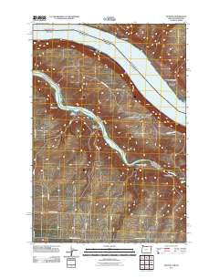
2011 Map of Quinton
USGS Topo · Published 2011About this map
Columbia River and John Day River dominate this landscape at their confluence on the border of Oregon and Washington. This 2011 survey captures the rugged drainage systems of the Columbia Plateau, where numerous canyons like Box Canyon and Biglow Canyon cut through the high desert terrain. The map records the sparse settlements of Goodnoe and Quinton, positioned along the northern bank of the Columbia, while identifying distinct natural landmarks such as The Nook and the Narrows.
Find a feature on this map
24 named features on this map. Tap any name to fly to it.
Don’t see what you’re looking for? This feature index may not catch every label — zoom into the map to look around manually.
Map Details
Editions of this 2011 Quinton Map
This is the sole edition of this map. No revisions or reprints were ever made.
Other maps of this area

1916 · Arlington
USGS Topo · 1:125,000

1953 · The Dalles
USGS Topo · 1:250,000

1956 · The Dalles
USGS Topo · 1:250,000

1957 · The Dalles
USGS Topo · 1:250,000

1957 · Wasco
USGS Topo · 1:62,500

1957 · Satus Pass
USGS Topo · 1:62,500

1964 · Mc Donald
USGS Topo · 1:24,000

1965 · Goodnoe Hills
USGS Topo · 1:24,000

1971 · Quinton
USGS Topo · 1:24,000
1971 · Sundale NW
USGS Topo · 1:24,000