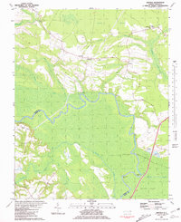
1981 Map of Quitsna
USGS Topo · Published 1981About this map
Roanoke River dominates the central landscape of this 1981 survey, carving dramatic oxbows like Conine Bend and Frying Pan Bend along the border of Bertie and Martin counties. The terrain is defined by low-lying wetlands and complex hydrology, including the expansive Roquist Pocosin and numerous drainages like Choowatic Creek and Greek Swamp. This riverine environment supported a network of historical access points, including Coniott Landing and Quitsna Landing.
Find a feature on this map
25 named features on this map. Tap any name to fly to it.
Don’t see what you’re looking for? This feature index may not catch every label — zoom into the map to look around manually.
Map Details
Editions of this 1981 Quitsna Map
This is the sole edition of this map. No revisions or reprints were ever made.
Other maps of this area

1901 · Williamston
USGS Topo · 1:62,500

1902 · Williamston
USGS Topo · 1:62,500

1943 · Plymouth
USGS Topo · 1:125,000

1953 · Norfolk
USGS Topo · 1:250,000

1953 · Rocky Mount
USGS Topo · 1:250,000

1954 · Rocky Mount
USGS Topo · 1:250,000

1972 · Republican
USGS Topo · 1:24,000

1972 · Woodville
USGS Topo · 1:24,000
1978 · Jamesville
USGS Topo · 1:24,000

1978 · Windsor South
USGS Topo · 1:24,000