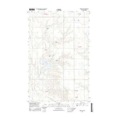
2017 Map of Rabbit Hills
USGS Topo · Published 2017About this map
Rabbit Hills and a complex network of coulees define this stretch of Blaine County, where the high plains are carved by drainage systems like Dry Fork Battle Cr and Battle Cr. This landscape is primarily shaped by its hydrology and terrain, with features such as Deadhorse Coulee and Boxelder Coulee cutting deep into the benchlands. The human footprint is represented by a sparse grid of rural roads, including Middle Rd and Hollandville Rd, which follow the township and range lines of the Public Land Survey System. These routes provide access to the remote pastures and drainages of the northern Montana borderlands, where water remains the most significant geographic marker. The confluence of Lodge Cr in the southwest corner and the presence of names like Coal Creek suggest a landscape valued for its natural resources and livestock grazing potential in the early 21st century.
Find a feature on this map
19 named features on this map. Tap any name to fly to it.
Don’t see what you’re looking for? This feature index may not catch every label — zoom into the map to look around manually.
Map Details
Editions of this 2017 Rabbit Hills Map
This is the sole edition of this map. No revisions or reprints were ever made.
Other maps of this area

1904 · Yantic
USGS Topo · 1:62,500

1904 · Chinook
USGS Topo · 1:62,500

1912 · Zurich
USGS Topo · 1:125,000

1953 · Havre
USGS Topo · 1:250,000

1957 · Havre
USGS Topo · 1:250,000

1958 · Havre
USGS Topo · 1:250,000

1964 · Rabbit Hills
USGS Topo · 1:24,000

1964 · Telescope Coulee
USGS Topo · 1:24,000
1964 · Lohman SE
USGS Topo · 1:24,000
1964 · Chinook
USGS Topo · 1:24,000