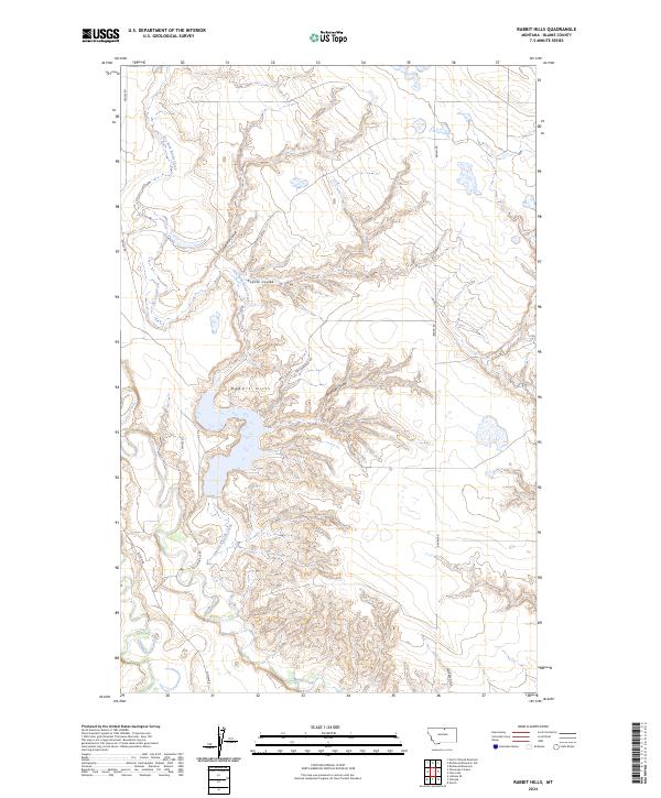
2024 Map of Rabbit Hills
USGS Topo · Published 2024About this map
Rabbit Hills dominates the topography of this corner of Blaine County, where a network of watercourses and seasonal drainages carves through the Montana landscape. The hydrology of the region is defined by the larger Battle Creek to the south and its prominent tributary, Dry Fork Battle Creek, which winds through the western sections. The map reveals the intricate drainage patterns of the high plains, evidenced by numerous named coulees such as Deadhorse Coulee, Coyote Coulee, and Boxelder Coulee. Human presence is marked primarily by a sparse network of section-line and connector roads, including Middle Rd and Hollandville Rd, which provide access through the complex terrain of Shimikin Gulch. This survey captures a rural landscape where the natural contours and water systems remain the primary features of interest for land use and navigation.
Find a feature on this map
20 named features on this map. Tap any name to fly to it.
Don’t see what you’re looking for? This feature index may not catch every label — zoom into the map to look around manually.
Map Details
Editions of this 2024 Rabbit Hills Map
This is the sole edition of this map. No revisions or reprints were ever made.
Other maps of this area

1904 · Yantic
USGS Topo · 1:62,500

1904 · Chinook
USGS Topo · 1:62,500

1912 · Zurich
USGS Topo · 1:125,000

1953 · Havre
USGS Topo · 1:250,000

1957 · Havre
USGS Topo · 1:250,000

1958 · Havre
USGS Topo · 1:250,000

1964 · Rabbit Hills
USGS Topo · 1:24,000

1964 · Telescope Coulee
USGS Topo · 1:24,000
1964 · Lohman SE
USGS Topo · 1:24,000
1964 · Chinook
USGS Topo · 1:24,000