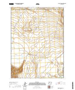
2020 Map of Rabbit Hills NE
USGS Topo · Published 2020About this map
The high desert landscape of the Oregon outback is defined by dramatic topographic shifts across the Harney and Lake County line. This 2020 survey highlights the unique hydrological and geological features of a basin-and-range environment where seasonal water is critical. To the north, Dudeck Ridge overlooks the expansive Rabbit Basin, while the southern reaches are dominated by the Rabbit Hills and the transition into Warner Valley. The presence of Rabbit Cr, Corral Waterhole, and Canterbury Reservoir underscores the vital role of intermittent water sources and storage in this arid livestock-grazing region. The map provides a contemporary look at the section lines and topography of this sparsely populated borderland, preserving the names of remote landmarks used by ranchers and outdoorsmen.
Find a feature on this map
8 named features on this map. Tap any name to fly to it.
Don’t see what you’re looking for? This feature index may not catch every label — zoom into the map to look around manually.
Map Details
Editions of this 2020 Rabbit Hills NE Map
This is the sole edition of this map. No revisions or reprints were ever made.
Other maps of this area

1955 · Adel
USGS Topo · 1:250,000

1957 · Adel
USGS Topo · 1:250,000

1958 · Adel
USGS Topo · 1:250,000

1962 · Adel
USGS Topo · 1:250,000

1966 · Rabbit Hills NE
USGS Topo · 1:24,000

1966 · Rabbit Hills NW
USGS Topo · 1:24,000

1967 · Flagstaff Lake
USGS Topo · 1:24,000

1967 · Rabbit Hills SW
USGS Topo · 1:24,000

1967 · Campbell Lake
USGS Topo · 1:24,000

1967 · Bluejoint Lake West
USGS Topo · 1:24,000