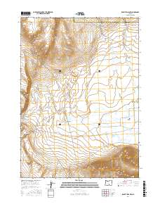
2017 Map of Rabbit Hills NW
USGS Topo · Published 2017About this map
Flint Hills and Flint Ridge dominate the northwestern portion of this high desert terrain, where the boundary between Harney and Lake County crosses the landscape. The area is defined by a series of intermittent drainage systems, most notably Rabbit Cr and Foley Cr, which descend through the eastern slopes toward the Rabbit Basin. In the north, the Sherlock Gulch Reservoir serves as a lone water storage point amidst the sagebrush and dry washes.
Find a feature on this map
17 named features on this map. Tap any name to fly to it.
Don’t see what you’re looking for? This feature index may not catch every label — zoom into the map to look around manually.
Map Details
Editions of this 2017 Rabbit Hills NW Map
This is the sole edition of this map. No revisions or reprints were ever made.
Other maps of this area

1955 · Klamath Falls
USGS Topo · 1:250,000

1955 · Adel
USGS Topo · 1:250,000

1957 · Adel
USGS Topo · 1:250,000

1958 · Klamath Falls
USGS Topo · 1:250,000

1958 · Adel
USGS Topo · 1:250,000

1962 · Adel
USGS Topo · 1:250,000

1966 · Rabbit Hills NE
USGS Topo · 1:24,000

1966 · Rabbit Hills NW
USGS Topo · 1:24,000

1967 · Flagstaff Lake
USGS Topo · 1:24,000

1967 · Rabbit Hills SW
USGS Topo · 1:24,000