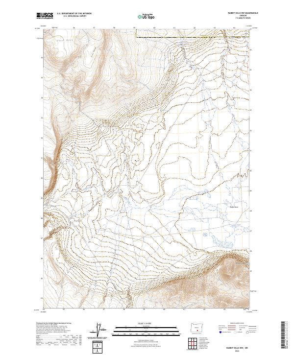
2024 Map of Rabbit Hills NW
USGS Topo · Published 2024About this map
Flint Hills and the steep elevation of Flint Ridge dominate the northwestern portion of this Lake County landscape, where high-desert drainage patterns define the local geography. Water management in this arid environment is evidenced by the Sherlock Gulch Reservoir near the northern boundary, collecting runoff before it reaches the lower elevations. The southern portion of the map transitions into the Rabbit Basin and the rising slopes of the Rabbit Hills, a region where seasonal waterways like Rabbit Creek, Foley Creek, and the uniquely named Mary Ann Draw carve through the terrain. Human presence is sparse and centered on functional transit routes such as Co Hwy 3-10 and Hogback Rd, illustrating the remote character of the Harney and Lake County borderlands.
Find a feature on this map
12 named features on this map. Tap any name to fly to it.
Don’t see what you’re looking for? This feature index may not catch every label — zoom into the map to look around manually.
Map Details
Editions of this 2024 Rabbit Hills NW Map
This is the sole edition of this map. No revisions or reprints were ever made.
Other maps of this area

1955 · Klamath Falls
USGS Topo · 1:250,000

1955 · Adel
USGS Topo · 1:250,000

1957 · Adel
USGS Topo · 1:250,000

1958 · Klamath Falls
USGS Topo · 1:250,000

1958 · Adel
USGS Topo · 1:250,000

1962 · Adel
USGS Topo · 1:250,000

1966 · Rabbit Hills NE
USGS Topo · 1:24,000

1966 · Rabbit Hills NW
USGS Topo · 1:24,000

1967 · Flagstaff Lake
USGS Topo · 1:24,000

1967 · Rabbit Hills SW
USGS Topo · 1:24,000