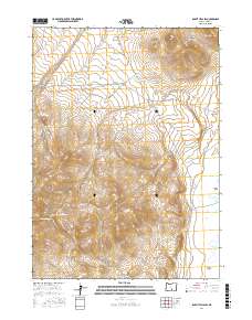
2017 Map of Rabbit Hills SW
USGS Topo · Published 2017About this map
Rabbit Hills and the Coyote Hills dominate this high-desert landscape in Lake County, Oregon, where the terrain transitions into the flat expanse of the Warner Valley. The map reveals a delicate network of seasonal water sources and drainage patterns essential to this arid environment, featuring Mary Ann Draw and Mulkey Wells Draw. Evidence of early resource management and ranching history is grounded in labels like Big Rock Reservoir and the Miners Draw Waterhole. The remote character of the region is underscored by the sparse infrastructure, primarily consisting of the unpaved CO Hwy 3-10 and CO Hwy 3-11, which provide the only managed access through the draws and across the elevated hills. Geologists and local historians can trace the specific hydrology of the area through landmarks such as Mine Draw Spring and the southern reach of Miners Draw.
Find a feature on this map
16 named features on this map. Tap any name to fly to it.
Don’t see what you’re looking for? This feature index may not catch every label — zoom into the map to look around manually.
Map Details
Editions of this 2017 Rabbit Hills SW Map
This is the sole edition of this map. No revisions or reprints were ever made.
Other maps of this area

1955 · Klamath Falls
USGS Topo · 1:250,000

1955 · Adel
USGS Topo · 1:250,000

1957 · Adel
USGS Topo · 1:250,000

1958 · Klamath Falls
USGS Topo · 1:250,000

1958 · Adel
USGS Topo · 1:250,000

1962 · Adel
USGS Topo · 1:250,000

1966 · Rabbit Hills NE
USGS Topo · 1:24,000

1966 · Rabbit Hills NW
USGS Topo · 1:24,000

1967 · Flagstaff Lake
USGS Topo · 1:24,000

1967 · Plush
USGS Topo · 1:24,000