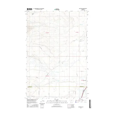
2017 Map of Racetrack
USGS Topo · Published 2017About this map
Racetrack and its surrounding ranchlands sit at the intersection of a complex irrigation network and historical travel corridors. This 2017 survey details the intensive water management required in this Montana landscape, where the Morrison Ditch, W. Side Canal, and various mountain-fed streams like Dempsey Cr and Racetrack Cr sustain the valley floor. The geography is defined by the transition from the high Morrison Gulch and Powell Reservoirs down to the Clark Fork river. The map documents the persistent layout of the Yellowstone Trl, a historic highway route that parallels the modern infrastructure. Along the boundary of the Powell Co Deer Lodge Co line, the grid of secondary roads like Dempsey Lake Rd and Upper Racetrack Rd provides a clear view of how land ownership and access are structured around the natural drainage of Modesty Cr and the larger valley floor.
Find a feature on this map
35 named features on this map. Tap any name to fly to it.
Don’t see what you’re looking for? This feature index may not catch every label — zoom into the map to look around manually.
Map Details
Editions of this 2017 Racetrack Map
This is the sole edition of this map. No revisions or reprints were ever made.
Other maps of this area

1889 · Helena
USGS Topo · 1:250,000

1893 · Helena
USGS Topo · 1:250,000

1899 · Helena
USGS Topo · 1:250,000

1903 · Helena
USGS Topo · 1:250,000

1947 · Butte
USGS Topo · 1:250,000

1958 · Butte
USGS Topo · 1:250,000

1959 · Butte North
USGS Topo · 1:62,500

1959 · Deer Lodge
USGS Topo · 1:62,500

1960 · Butte
USGS Topo · 1:250,000

1961 · Anaconda
USGS Topo · 1:62,500