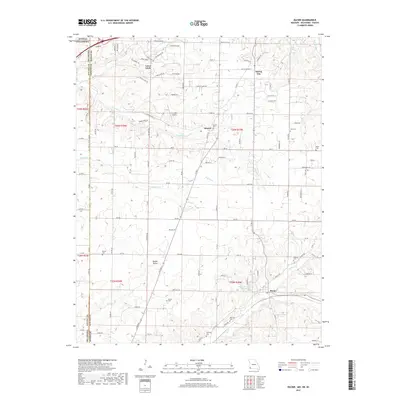
2017 Map of Racine
USGS Topo · Published 2017About this map
Loma Linda and the surrounding rural landscape of Newton County sit at the crossroads of history, where the boundaries of Missouri, Kansas, and Oklahoma meet. This corner of the Ozarks transition reflects a quiet residential and agricultural character, punctuated by legacy burial grounds like Hornet Cem and the Buzzard Cem. The hydrology is defined by the winding course of Fivemile Cr and Lost Cr, which feed the Austin Harrison Reservoir near the settlement of Racine. A network of country lanes, such as Butterfield Dr and Thrifty Acres Rd, connects small communities like Spring City and Modoc Valley. The presence of the Five Mile Airport amidst the creek branches and family-named cemeteries such as Moser Cem and Gibson Cem offers a detailed view of the local land use and genealogy before further modern development.
Find a feature on this map
115 named features on this map. Tap any name to fly to it.
Don’t see what you’re looking for? This feature index may not catch every label — zoom into the map to look around manually.
Map Details
Editions of this 2017 Racine Map
This is the sole edition of this map. No revisions or reprints were ever made.
Other maps of this area

1886 · Joplin
USGS Topo · 1:125,000

1886 · Carthage
USGS Topo · 1:125,000

1894 · Joplin
USGS Topo · 1:125,000

1894 · Carthage
USGS Topo · 1:125,000

1907 · Wyandotte
USGS Topo · 1:125,000

1909 · Wyandotte
USGS Topo · 1:125,000

1916 · Neosho
USGS Topo · 1:62,500

1947 · Joplin
USGS Topo · 1:250,000

1949 · Joplin
USGS Topo · 1:250,000

1949 · Seneca
USGS Topo · 1:24,000