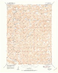
1951 Map of Rackett
USGS Topo · Published 1951About this map
Crescent Lake National Wildlife Refuge dominates the northwestern corner of this Garden County landscape, showing the transition from protected wetlands to the working cattle country of the Nebraska Sandhills. The settlement pattern is defined by isolated outposts and specialized camps like Peterson Camp, Wells Camp, and Avery Camp, reflecting a ranching economy that relied on widely dispersed water sources and seasonal stations.
Find a feature on this map
37 named features on this map. Tap any name to fly to it.
Don’t see what you’re looking for? This feature index may not catch every label — zoom into the map to look around manually.
Map Details
Editions of this 1951 Rackett Map
2 editions found

Other maps of this area

1897 · Ogallala
USGS Topo · 1:125,000

1900 · Chappell
USGS Topo · 1:125,000

1900 · Ogallala
USGS Topo · 1:125,000

1948 · George Lake
USGS Topo · 1:62,500

1949 · Mumper
USGS Topo · 1:62,500

1949 · Rackett
USGS Topo · 1:62,500

1950 · Velma
USGS Topo · 1:62,500

1950 · Crescent Lake
USGS Topo · 1:62,500

1950 · George Lake
USGS Topo · 1:62,500

1950 · Longfellow Lake
USGS Topo · 1:62,500