
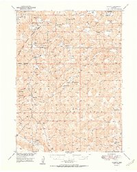
1951 Map of Rackett
USGS Topo · Published 1951About this map
Crescent Lake National Wildlife Refuge dominates the northwestern portion of this 1951 Garden County landscape, where the Sandhills terrain transitions into the broad valley of Blue Creek. The settlement pattern here is defined by isolated cattle ranching and camps, with family names like Keenan, Hisel, and Rounsburg marking the vast open ranges. These ranching outposts were supported by a network of one-room schoolhouses, including Well Valley Sch, School No 31, and School No 12, which served the local families across the various valleys.
Find a feature on this map
37 named features on this map. Tap any name to fly to it.
Don’t see what you’re looking for? This feature index may not catch every label — zoom into the map to look around manually.
Map Details
Editions of this 1951 Rackett Map
2 editions found
Other maps of this area

1897 · Ogallala
USGS Topo · 1:125,000

1900 · Chappell
USGS Topo · 1:125,000

1900 · Ogallala
USGS Topo · 1:125,000

1948 · George Lake
USGS Topo · 1:62,500

1949 · Mumper
USGS Topo · 1:62,500

1949 · Rackett
USGS Topo · 1:62,500

1950 · Velma
USGS Topo · 1:62,500

1950 · Crescent Lake
USGS Topo · 1:62,500

1950 · George Lake
USGS Topo · 1:62,500

1950 · Longfellow Lake
USGS Topo · 1:62,500